Everest Base Camp Trek Via Gokyo Lake

Tour Info

Trip code

E-006

Starting Point/ End Point

Kathmandu

Accommodations

Lodge/Tea House

Max Altitude

5,545 meters (Kala Patthar)

Duration

18 days

country

Trip grade

Challenging

Best Season

Spring (March–May) and Autumn (September–November)

Highlights

  • Scenic mountain flight to Lukla with stunning Himalayan views
  • Visit and explore the cultural and tourist center of the Everest region, Namche bazar
  • Get to Sagarmatha National Park, a UNESCO World Heritage Site
  • Take in sight of the magnificent Everest, Lhotse, Makalu, Cho Oyu, Ama Dablam and more peaks in the Himalayas
  • Witness the amazing Khumbu Icefall and get to Everest Base Camp (5,364m).
  • Hike up to Kala Patthar (5,545m) to catch sight of the best sunrise view of Everest mountain
  • Crossing the difficult Cho La Pass (5420m) and have a high altitude adventure
  • Visit the serene Gokyo Valley, the turquoise Gokyo Lakes and the panoramic view of Gokyo Ri (5360m)
  • Explore typical Sherpa villages, monasteries, prayer wheels, mani walls, and prayer flags
  • Experience the combination of Everest Base Camp together with full days of Gokyo Lakes and Cho La Pass and lots of Sherpa culture

Overview

Everest Base Camp Trek via Gokyo Lake is one of the most complete and dramatic trekking route in Nepal. It is the combination of Everest Base Camp (5364m), Gokyo Ri (5357m) and Cho La pass (5420m) which adds some variety to the trekking experience as compared to the standard Everest Base Camp trek route. This trek passes through famous landmarks of the Himalayas, serene valleys, turquoise glacial lakes and high passes located in the Khumbu region, within Sagarmatha National Park. The journey begins with a scenic adventure to Lukla at 2,860 meters, then continues through Sherpa villages, woods, rivers and suspension bridges. At Namche Bazaar, Dingboche and Gokyo are carefully planned acclimatization stops that help ensure safe altitude-gaining. Overall, the trek balances culture, nature and high altitude adventure and offers safe and comfortable hours daily as trekking

Itinerary

Day 1: Arrival in Kathmandu

Our representative welcomes you at Tribhuvan International Airport and then transfers you at your hotel in Kathmandu. After arriving at the hotel, our staff assists you with the check-in procedure. Once you settle in your hotel room, you can rest for a while after traveling.  You can visit our office if you would like to know more information and details about the upcoming trip.

  • Max Elevation: 1400 meters (Kathmandu)
  • Travel Distance: 6 to 8 kilometers
  • Travel Hours: 20 to 30 minutes
  • Accommodation: 3 Star Hotel
  • Meal: Dinner
Day 2: Trek Briefing and Kathmandu Sightseeing

Swayambhunath Stupa (Monkey Temple): You can get the panoramic view from the top of the stupa at this Buddhist Temple. It is also known as Monkey Temple because of the monkeys who reside there.

Pashupatinath Temple: This is one of the major Hindu Temples dedicated to Lord Shiva situated on the banks of the Bagmati River. You can get a view of the Pashupatinath temple from the Eastern side, which is the only way that Hindus are allowed to enter the temple. 

Boudhanath Stupa: One of the holiest Buddhist sites that is one of the most sacred places in Kathmandu, constructed in the 5th century. Famous for its huge stupa, Buddha's eyes and prayer wheel circulation.

Patan Durbar Square: An elegant Newari architecture with great art heritage located at Lalitpur, Patan. After this tour, you head back to your hotel to stay overnight. 

  • Max Elevation: 1400 meters (Kathmandu city)
  • Travel Distance: 40 to 50 kilometers (total driving time for the whole day tour)
  • Travel Hours: 6 to 7 hours
  • Accommodation: 3-star standard Hotel
  • Meal: Breakfast, Lunch and Dinner
Drive to Ramechhap (1,218m) 4 to 5 hour drive, Flight to Lukla(2,860m) 20 minutes and then trek to Phakding (2,610 meters) 3 hours walk

Trek starts early in the morning by taking a scenic flight from Kathmandu to Lukla. This is a short flight with stunning views of hills and mountains before landing in one of the most thrilling airports in the world. Once you've arrived in Lukla, the trek officially starts with a slow walk towards Phakding. Trail is mostly downhill and follows the beautiful Dudh Koshi River. You pass through small villages, prayer stones, and prayer flags of the local culture along the way. Its easy and peaceful walking, which makes it a good start for the journey. After walking around 3 hours, you arrive at Phakding where you relax, explore the village, and enjoy a warm evening meal before heading out again on the following day.

It should also be noted that in the high peak season, you shall take the route from Kathmandu to Ramechhap airport. Flights are operated from this region instead of Lukla during peak season because of air traffic management. The drive usually takes around 4 to 5 hours depending on traffic amount and road conditions. From the airport in Ramechhap, you then take a flight to Lukla which takes approximately 20 minutes before heading to the pre-booked teahouse for the night. 

  • Max Elevation: 2 850 meters (Lukla)
  • Travel Distance: 7 to 8 kilometers
  • Travel Hours: 30 to 40 minutes flight + 3 hours trek or 4 to 5 hours drive, 20 minutes flight + 3 hours trek
  • Accommodation: Tea house /Lodge
  • Meal: Breakfast, Lunch, and Dinner
Day 4: Trek to Namche Bazaar (3,440 meters) 6 to 7 hours walk

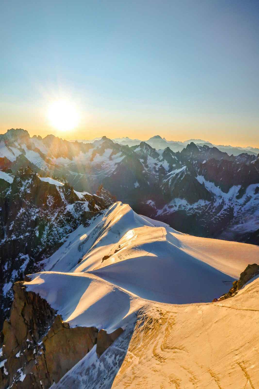
The journey begins with breakfast, followed by the start of the hike to Namche Bazaar. The trail will take you up hills with the most stunning scenery, like beautiful Sherpa villages, green forests, and rhododendron trees. You cross many suspension bridges, such as the Hillary Bridge, and have warm greetings from the locals. In just a couple of hours, your journey leads to the Sagarmatha National Park, which is listed as a World Heritage Site by UNESCO. From here on, the trail will become steep and difficult.
If you are lucky and weather conditions are clear, there is a good chance of catching your first glimpse of Mt. Everest during the trek. You may also be fortunate enough to spot the Danphe (*Lophophorus impejanus*), Nepal’s national bird, known for its colourful and iridescent feathers.

You may feel tired because of the uphill walk, but the scenery around will keep you motivated, and after about 6 to 7 hours of trekking, you finally reach Namche Bazaar. The vibrant homes and lively atmosphere welcome you to Namche Bazaar, where you can rest at your teahouse after a long day.

  • Max Elevation: 3,440 meters (Namche Bazaar)
  • Travel Distance: 10 to 12 kilometers
  • Travel Hours: 6 to 7 hours
  • Accommodation: Tea house / Lodge
  • Meal: Breakfast, Lunch, and Dinner
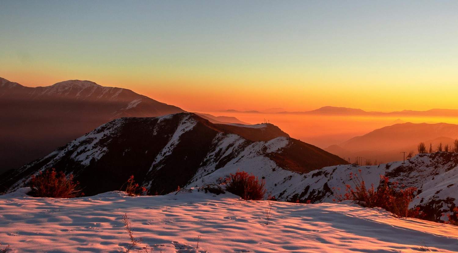
 

Day 5: Acclimatization day in Namche Bazaar (3,440 meters) explore Namche Bazaar and hike to Everest View Hotel (3,880 meters) 3 to 4 hours walk

This is an important acclimatization day to help your body adjust to the high altitude. After breakfast, you hike up to the Everest View Hotel (3,880m) from Namche Bazaar. Here you can see the beautiful Mount Everest, Lhotse, Ama Dablam, Thamserku, Tabuche, and many other mountains around. The trail may also continue towards Khumjung village, a typical Sherpa settlement with a monastery, stone houses, and a school dedicated to Sir Edmund Hillary and Tenzing Norgay Sherpa if you make a special request. Exploring in the morning, you return to Namche Bazaar in the afternoon.

Known as the "Sherpa Capital," Namche Bazaar is the gateway to Everest trekking routes and a key acclimatization stop. Built in a natural amphitheater, it offers views of Kongde Ri and, on clear days, Mount Everest on the opposite side. Despite its remote location, the town features hotels, cafés, bakeries, trekking shops, banks, internet services, medical facilities, and a traditional Saturday market. The rest of the day is your choice, whether you want to relax, explore local shops, or enjoy the mountain atmosphere.

  • Max Elevation: 3,880 meters (Everest View Hotel)
  • Travel Distance: 5 to 6 kilometers
  • Travel Hour: 3 to 4 hours
  • Accommodation: Tea house /Lodge
  • Meal: Breakfast, Lunch, and Dinner
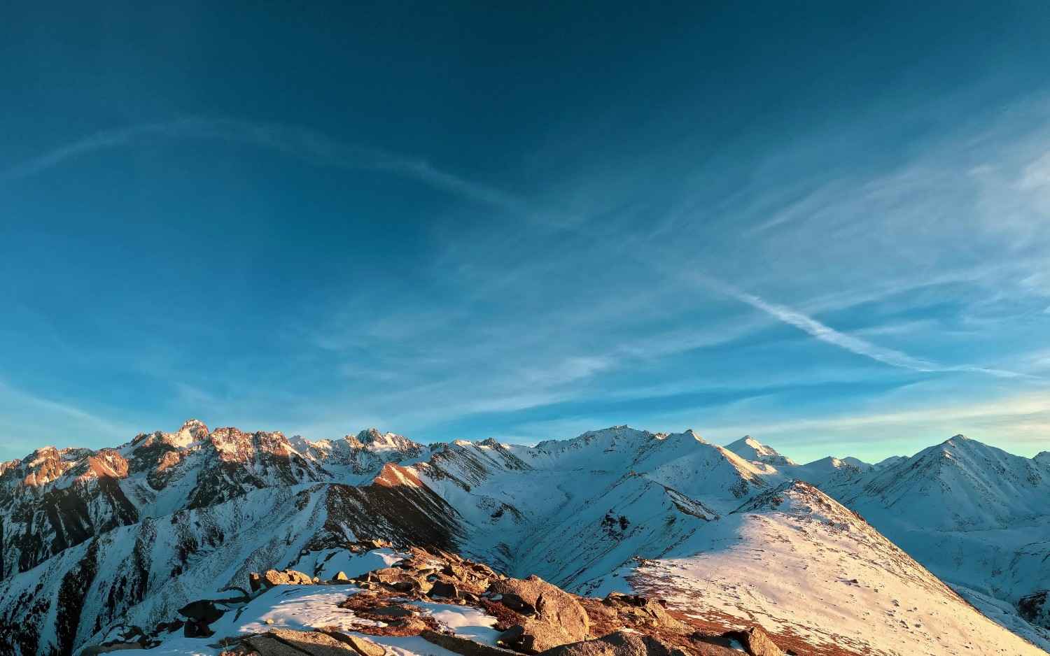
 

Day 6: Trek to Tengboche (3,867 meters) 5 to 6 hours walk

Once breakfast is over, you get started on your walk to Tengboche from Namche Bazaar with an average distance of around 10 km walking through the middle of the Khumbu valley. Your trekking path will take you past picturesque villages like Kenjoma, Sanasa, and Phunki Tenga while surrounded by beautiful Himalayas all day long. Once you reach Phunki Tenga, you will have to cross a suspension bridge over the Dudh Koshi River and then start the final climb to Tengboche.

During the trekking path, you can see prayer flags in beautiful colors, Mani walls with carvings, prayer wheels, as well as Tenzing Norgay Memorial Chorten along the way. There are possibilities to see a variety of Himalayan plants and animals during the trek, along with some breathtaking views of the famous mountains. Finally, when you are approaching Tengboche, you can see the famous monastery coming into sight. After 3:00 PM, you will have the opportunity to visit the monastery and attend the afternoon Buddhist prayer ceremony (Puja), where monks gather to chant prayers in a peaceful and spiritual atmosphere.

After a few hours of hiking, you reach Tengboche, which is your destination for today, and there, a welcome dinner awaits you.

  • Max Elevation: 3,867 meters (Tengboche)
  • Travel Distance: 10 kilometers
  • Travel Hour: 5 to 6 hours
  • Accommodation: Tea house /Lodge
  • Meal: Breakfast, Lunch, and Dinner

Day 7: Trek to Dingboche (4,410 meters) 5 to 6 hours walk

After having a nice breakfast, you set off from Tengboche and head towards Dingboche. You descend through the picturesque rhododendron forest to Debuche and then cross the Imja Khola by a suspension bridge. After this point, the trail climbs up via the traditional Sherpa villages of Pangboche, Shomare, and Orsho, giving you interesting insights into the mountain culture of this place. You come across old monasteries, farms, stony fields, and herds of yaks along the way.

However, as you reach higher ground, you get closer to a rough and open terrain that provides breathtaking sights of the Himalayan peaks up close. During your journey, you can have a panoramic view of Ama Dablam, Lhotse and Nuptse from varying angles, and you will see Ama Dablam at its best during your climb through this stretch of the trail. Even though there is a scenic mountain view at Dingboche, you won’t see Mt. Everest as it is blocked by the gigantic Nuptse-Lhotse ridge. You will face stretches of rocky and steep terrain and loose scree, which calls for an unhurried walk. It takes 5 to 6 hours of walking to reach Dingboche, a beautiful village where you can rest and eat your dinner before moving on.

  • Max Elevation: 4,410 meters (Dingboche)
  • Travel Distance: 10 to 11 kilometers
  • Travel Hours: 5 to 6 hours
  • Accommodation: Tea house / Lodge
  • Meal: Breakfast, Lunch, and Dinner

Day 8: Acclimatization day in Dingboche (4,410 meters) explore Dingboche and little hike up hills 2 to 3 hours

Eighth day is specified specifically for acclimatization. It allows your body to get adjusted gradually to the increase in altitude before moving deeper into the Everest region. After enjoying breakfast, you go for a small hike to the hills above Dingboche. The path is gradual, giving way to panoramic views of the whole Himalayan area. They include such peaks as Ama Dablam, Lhotse, Nuptse, Island Peak and the Imja Valley. In this case, the hiking technique of "climb high, sleep low" applies to help your body get adapted and enjoy great mountain scenery.

Once you come back to Dingboche, you will have an opportunity to explore this beautiful Sherpa village. While walking around the village, you will be able to see how people live, visit cafes and bakeries and learn about Khumbu culture and traditions from your guide. You will also notice the field walls made of stone, protecting the crops from mountain winds and animals that might graze there. While the views from Dingboche are breathtaking, Mount Everest is still hidden behind the giant Nuptse-Lhotse wall. After an interesting acclimatization and exploring the village day, you will come back to your hotel to have dinner and stay overnight.

  • Max Elevation: 4,410 meters (Dingboche)
  • Travel Distance: 3 to 4 kilometers
  • Travel Hours: 2 to 3 hours
  • Accommodation: Tea house /Lodge
  • Meal: Breakfast, Lunch, and Dinner

Day 9: Trek to Lobuche (4,910 meters) 5 to 6 hours

After taking your breakfast, you commence your walk from Dingboche towards exploring the Khumbu area, moving until you get to Lobuche. As you walk, you will have a gradual climb in an alpine environment along the path of the Dusa River that gives you scenic views of the Himalayan scenery. Ama Dablam remains visible for much of the journey, accompanying you as you make your way towards Lobuche. On the way to Thukla (Dughla) village, you will encounter numerous yak pastures, rocky gorges, and spectacular mountain landscapes.
Upon your halt to have some lunch at Thukla, you commence on the journey to the top of Thukla Pass, also known as Chupki Lhara, which takes around one hour. It is a sacred ridge with a number of monuments that honor the memory of those climbers and Sherpas who died while climbing Mount Everest and other peaks of the Himalayas. After that, you follow the lateral moraine of the Khumbu Glacier and see the splendid scenery of Mount Pumori, Nuptse, which offers one of the best views of the trek, Lobuche East, Taboche, Cholatse, and even the faraway Khumbu Glacier. Climbing through glaciers and rocks, you reach the little village of Lobuche. Being situated amid great mountain ranges, it is an important starting point for the Everest Base Camp expedition. Once you arrive at the Lobuche, you stop for the night in a tea house.

  • Max Elevation: 4,910 meters (Lobuche)
  • Travel Distance: 8 to 9 kilometers
  • Travel Hour: 5 to 6 hours
  • Accommodation: Tea house /Lodge
  • Meal: Breakfast, Lunch, and Dinner

Day 10: Trek to Gorakshep (5,170 meters) 3 hours walk and visit EBC (5,364 meters) 4 hours walk up and down

Today will be one of the most thrilling milestones in the entire journey as you proceed towards the Mount Everest Base Camp. You will set out on this day after having an early breakfast at Lobuche and then start your journey on the Khumbu Valley trail towards Gorakshep. Along the way, you will see some breathtaking views of the Khumbu Glacier and the world-renowned Khumbu Icefall, along with wonderful views of Pumori, Nuptse, Lingtren, Khumbutse, Changtse, and the Lho La Pass. On a clear day, you might also get to see the summit of Mount Everest rising up above the ridges. You finally make it to Gorakshep after a hike of about three hours on such wonderful ground.
Once you arrive at Gorakshep, you check in to your teahouse, enjoy a light lunch, and take a short rest before continuing to Everest Base Camp. The journey is done by walking through rock glaciers, dried-up lakes and loose rocks. The closer you approach the base camp, the more spectacular the surroundings get, with awe-inspiring peaks, huge glaciers, and the ever-present Khumbu Icefall being prominent features of the environment. Climbing to the height of 5,346 meters in order to reach the Mount Everest Base Camp makes you feel proud and fulfilled. After having spent some time around the Base Camp, taking photos, and feeling proud of yourself, you head back to your lodging facility in Gorakshep. The round trip from Gorakshep to Everest Base Camp takes about 4 hours.

  • Max Elevation: 5,364 meters (Everest Base Camp)
  • Travel Distance: 10 to 12 kilometers
  • Travel Hours: 7 hours (3 hours to Gorakshep + 4 hours EBC round trip)
  • Accommodation: Tea house /Lodge
  • Meal: Breakfast, Lunch, and Dinner 

 

Day 11: Kala Patthar (5,545 meters) 2 hours steep up sunrise view and trek to Dzonglho (4,830m) 4 hours

Your journey starts well before dawn when you head on the challenging trek to Kala Patthar, which is the peak you will reach during your trek. Though this trek is challenging, the journey is always worth it as you can reach one of the most picturesque spots in the Himalayas. Reaching the top at the moment when the sun’s rays fall on the mountains is a remarkable experience in itself. From there, you get a view of many magnificent peaks, including Mount Everest, Nuptse, Pumori, Lingtren, Khumbutse, and many other snow-clad peaks.

Taking some leisure time to view the surroundings and take pictures, you start going back down to Gorakshep for breakfast and then move on ahead. Once you leave behind the Everest Base Camp trek route, you will be walking along a less frequented path leading towards Dzongla. Your trek will pass through a rocky glacial path which has wonderful sights of the Khumbu Glacier and will then ascend up through undulating hills. With the reduction in the number of people, you are sure to experience an isolated environment with a different perception of Everest.

  • Max Elevation: 5,545 meters (Kala Patthar)
  • Travel Distance: 8 to 9 kilometers
  • Travel Hours: 6 hours (2 hours climb + 4 hours trek)
  • Accommodation: Tea house /Lodge
  • Meal: Breakfast, Lunch, and Dinner

Day 12: Trek ko Gokyo (4,790 meters) via Cho La Pass (5,420 meters) 8 to 9 hours walk

This might be the hardest but also the most interesting part of the trek as you make your way past the famed Cho La Pass and through the breathtaking Gokyo Valley. The journey begins with a slow and gradual climb along steep and rocky trails that have glacier views, with due care being taken while walking at a steady pace. As you continue moving higher and higher, you are treated to wonderful mountain views with snowy and icy mountains surrounding you. You finally reach the top of Cho La Pass, which is located at an elevation of 5,420 meters, and is presented with glorious views of glaciers and Himalayan peaks. Once you have spent some time at the pass, you start descending to Dragnak, stopping there for lunch before proceeding further. 

Cho La Pass can be considered one of the busiest passes in the area as it connects the route to the Everest Base Camp with the Gokyo Valley. You will also get an opportunity to see the Ama Dablam, Thamserku, Lobuche East and some other mountains in the surroundings. Then, you will cross the Ngozumpa Glacier, which is the biggest glacier in Nepal, and enter the Gokyo Valley. Unlike the harsh scenery of the pass, Gokyo is waiting to welcome you with its beautiful turquoise lakes, vast alpine sceneries and the peacefulness of the mountains. Moreover, you will get a chance to view from the village the magnificent views of Cho Oyu, which is the sixth-highest mountain in the world.

  • Max Elevation: 5,420 meters (Cho La Pass)
  • Travel Distance: 10 to 12 kilometers
  • Travel Hours: 8 to 9 hours
  • Accommodation: Tea house /Lodge
  • Meal: Breakfast, Lunch, and Dinner

Day 13: Hike to Gokyo Ri (5,360 meters) 4 to 5 hours walk and rest day in Gokyo

This is the day that will be devoted to discovering one of the most impressive views in the Everest area while providing your body more time to acclimatize. You start your walk to Gokyo Ri very early in the morning by a challenging but fascinating ascent above the Gokyo Lakes. The more you ascend, the more you can see the amazing turquoise Gokyo lakes, which make a striking contrast with the majestic mountains and the glaciers around them.

Once on the top of Gokyo Ri at an altitude of 5,360 meters, you can enjoy one of the most impressive panoramas in the Himalayas. The stunning viewpoint gives you a chance to observe the north face view of Mount Everest from here, Lhotse, Makalu, and Cho Oyu peaks, along with the huge Ngozumpa Glacier stretching in the valley down below. This viewpoint allows you to enjoy the wonderful 360-degree panorama of the entire Everest area. Once you have finished admiring the amazing views and taking the pictures, you return to Gokyo. The rest of the day is free for you to relax at the lake shore, visit the small village, and just relax in this beautiful mountainous environment.

  • Max Elevation: 5,360 meters (Gokyo Ri)
  • Travel Distance: 4 to 5 kilometers
  • Travel Hours: 4 to 5 hours
  • Accommodation: Tea house /Lodge
  • Meal: Breakfast, Lunch, and Dinner

 

Day 14: Trek back to Dole (4,110 meters) 4 to 5 hours walk

You start heading back down towards Dole after breakfast in Gokyo. The route gradually descends through open valleys, rocky trails, and beautiful mountain scenery, with occasional views of Cho Oyu, Kangtega, Thamserku, and surrounding Himalayan peaks along the way. Along the way, you pass through Machhermo, cross the 1st and 2nd lakes from Gokyo, and continue through yak grazing areas and traditional mountain settlements. As you leave Gokyo behind, the landscape slowly changes from rugged alpine terrain to greener hillsides and sheltered valleys. This walk feels easier after the higher elevations, though care is still needed on rocky sections. After around 4 to 5 hours of walking, you arrive at Dole, a quiet village surrounded by hills and mountains where you can rest after the descent. 

  • Max Elevation: 4,110 meters (Dole)
  • Travel Distance: 9 to 10 kilometers
  • Travel Hours: 4 to 5 hours
  • Accommodation: Tea house /Lodge
  • Meal: Breakfast, Lunch, and Dinner
Day 15: Trek back to Namche Bazaar (3,440 meters) 5 to 6 hours walk

After breakfast, you keep moving down to Namche Bazaar via mountain trails and Sherpa villages, traveling back on the same path you followed on your journey up. The trail takes you via Mong La to Kyangjuma, where you make a halt for lunch while relishing the mountain environment around you. Throughout the path, one gets to see the surrounding peaks, forests, and valleys. While descending, one gets to see many rhododendron and pine forests on the sides of the path.

It is much easier to walk downhill since it is easier on your breathing system, but there are some parts that are still rocky. You could be fortunate enough to come across a pheasant, musk deer, or mountain goat while descending. After walking for about 5-6 hours, you reach Namche Bazaar, where you get time to take a comfortable rest.

  • Max Elevation: 4,110 meters (starting point from Dole area)
  • Travel Distance: 10 to 11 kilometers
  • Travel Hours: 5 to 6 hours
  • Accommodation: Tea house /Lodge
  • Meal: Breakfast, Lunch, and Dinner


Day 16: Trek back to Lukla (2,850 meters) 6 to 7 walk

After breakfast, you begin your final day of trekking as you make your way back to Lukla. The trail follows the Dudh Koshi River, crossing suspension bridges and passing through familiar villages including Monjo and Phakding. There are still some rocky sections, so you continue at a comfortable pace. As you descend, the trail passes through rhododendron forests and open landscapes with distant views of snow-covered peaks. The sound of the river accompanies the walk, making for a scenic final day in the mountains. After around 6 to 7 hours of walking, you arrive in Lukla where you can check into the teahouse, relax, and celebrate the successful completion of your trek in the Everest region.

  • Max Elevation: 3,440 meters (start from Namche region)
  • Travel Distance: 17 to 18 kilometers
  • Travel Hours: 7 to 8 hours
  • Accommodation: Tea house /Lodge
  • Meal: Breakfast, Lunch, and Dinner


Day 17: Flight to Kathmandu 40 minutes

From Lukla, you take early morning flight back to Kathmandu. This short mountain flight offers one last time chance to enjoy the beauty of Himalayas such as the ones of Mt. Gaurishankhar and Numbur Himal from above. On a clear day, you are able to view hills and valleys and distant peaks as you travel along. After about 40 to 45 minutes of flight, you reach Kathmandu, where you will get picked up and taken to your hotel by our representative. The rest of the day is free for you to relax, shop, or sightsee during the city. Most of the trekkers also enjoy reflecting on their journey. It's a great opportunity to enjoy the completed hike and the final night in Nepal in the evening.

  • Max Elevation: 2,850 meters (Lukla)
  • Travel Distance: 138 kilometers (flight distance)
  • Travel Hours: 40 to 45 minutes flight
  • Accommodation: 3 Star Hotel
  • Meal: Breakfast, Lunch, and Dinner
Day 18: Departure

On your last day in Nepal, you pack up your bags and prepare for your departure from Tribhuvan International Airport. Depending on your flight schedule, you will be transferred from your hotel at the planned time. It is advised to arrive at the airport 3 hours prior to flight. Before departure, this will be time to buy last minute souvenirs or explore Kathmandu Valley. This is the last opportunity to visit the cultural city, and carry home good memories from your trip. Later, you will be dropped at the airport for your onward journey, marking the end of your Everest Base Camp via Gokyo Lakes trek in Nepal.

  • Max Elevation: 1,400 meters (Kathmandu)
  • Travel Distance: 6 to 8 kilometers (hotel to airport)
  • Travel Hours: 30 to 40 minutes drive
  • Meal:  Breakfast

Lukla Flight

Most trekkers reach the Everest region via a short, scenic flight to Tenzing-Hillary Airport (LUA) in Lukla. During the peak trekking seasons (March–May and October–November), flights are often rerouted to depart from Manthali Airport in Ramechhap instead of Kathmandu to reduce air traffic congestion.Most trekkers reach the Everest region via a short, scenic flight to Tenzing-Hillary Airport (LUA) in Lukla. During the peak trekking seasons (March–May and October–November), flights are often rerouted to depart from Manthali Airport in Ramechhap instead of Kathmandu to reduce air traffic congestion.

Most trekkers reach the Everest region via a short, scenic flight to Tenzing-Hillary Airport (LUA) in Lukla. During the peak trekking seasons (March–May and October–November), flights are often rerouted to depart from Manthali Airport in Ramechhap instead of Kathmandu to reduce air traffic congestion.Most trekkers reach the Everest region via a short, scenic flight to Tenzing-Hillary Airport (LUA) in Lukla. During the peak trekking seasons (March–May and October–November), flights are often rerouted to depart from Manthali Airport in Ramechhap instead of Kathmandu to reduce air traffic congestion.

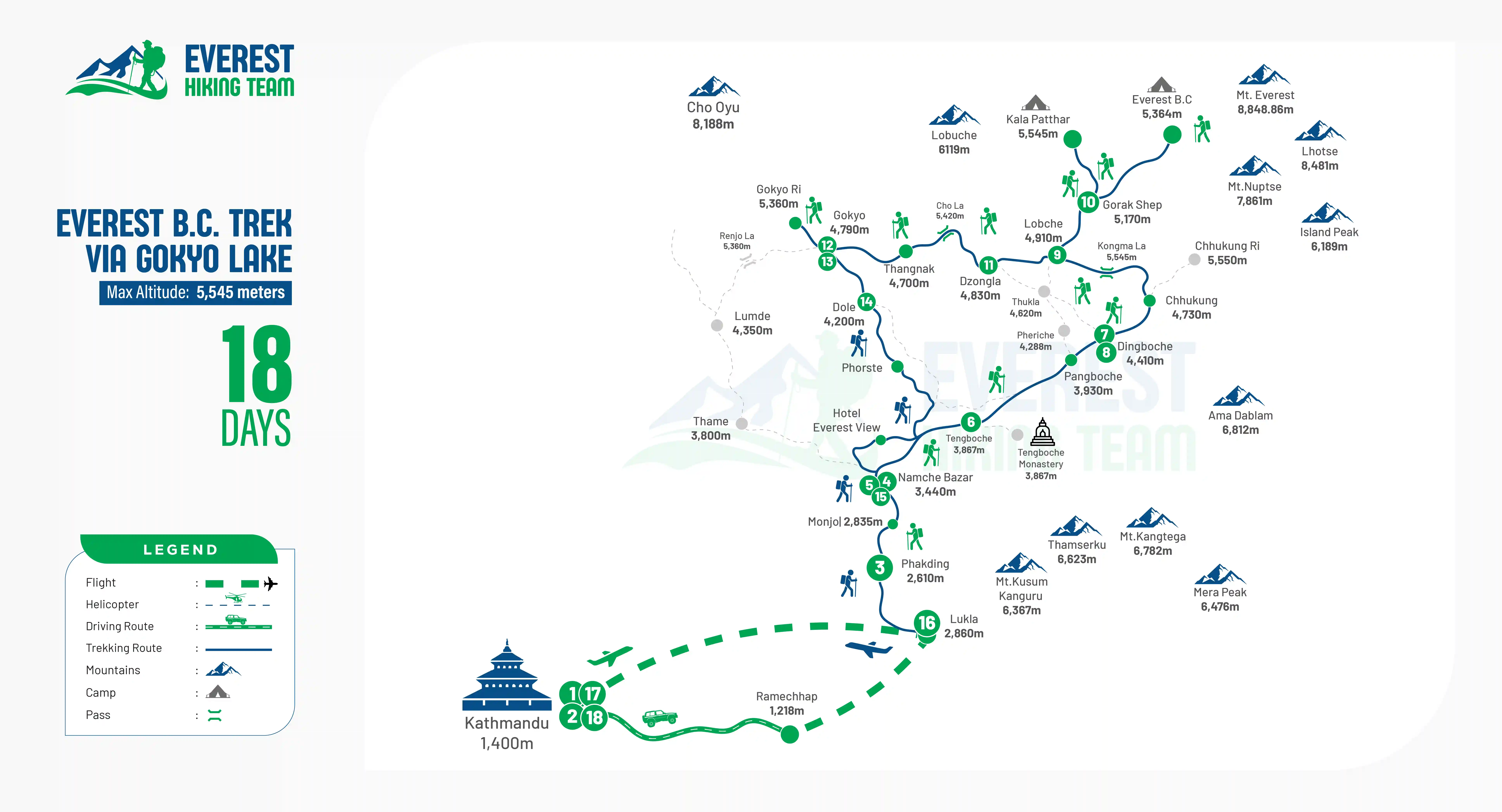
Trek Route

Everest B.C trek Via Gokyo Lake 18 days

Packing List

General

  • Four-season (0°C to -15°C) sleeping bag
  • Puffy down jacket
  • Daypack (35–45 liters) with rain cover
  • Sleeping bag liner
  • Duffel bag for porter transport
  • Waterproof dry bags

Upper Body 

  • Sun hat or cap
  • Warm knitted hat or beanie
  • Headlamp with spare batteries
  • UV-protection sunglasses
  • Light thermal base layer
  • Heavy thermal base layer (for colder months)
  • 2 short-sleeve trekking shirts
  • 2 long-sleeve trekking shirts
  • Waterproof and windproof shell jacket
  • Fleece jacket or warm pullover
  • Down jacket

Lower Body

  • Thermal base layer bottoms
  • 2 pairs of trekking pants
  • Hiking shorts
  • Comfortable pants for evenings in teahouses
  • Waterproof and windproof shell trousers

Hands

  • Lightweight lHandiner gloves
  • Insulated waterproof outer gloves

Feet

  • Warm wool trekking socks
  • Regular hiking socks
  • Liner socks (optional)
  • Waterproof trekking boots
  • Microspikes or ice cleats (especially during winter and spring)
  • Comfortable camp shoes or sandals
  • Lightweight gaiters for dust or snow gaiters during colder months

Undergarments

  • Quick-drying underwear
  • Sports bras (for women)
  • Sleepwear or pajamas

First Aid and Personal Medications

  • Personal medications
  • Sunscreen (SPF 50+)
  • Lip balm
  • Antiseptic ointment
  • Band-aids and blister treatment
  • Pain relief medication
  • Oral rehydration salts
  • Diamox (consult your doctor before use)

Other Essentials

  • Passport
  • Extra passport-size photos
  • Travel insurance documents
  • Reusable water bottles
  • Hydration bladder
  • Water purification tablets or UV purifier
  • Personal toiletries
  • Quick-dry towel
  • Pillowcase
  • Toilet paper
  • Hand sanitizer
  • Wet wipes
  • High-energy snacks, protein bars, nuts, or chocolates
  • Waterproof bags for valuables and documents
  • Earplugs
  • Trekking poles

Optional Items

  • Power bank
  • Spare batteries
  • Camera and accessories
  • Mobile phone
  • Travel adapter
  • Book, journal, or playing cards
  • Binoculars
  • Whistle
  • Thermos flask for hot water
  • Comb
  • Small sewing kit

What's included

  • Domestic flight tickets from Kathmandu to Lukla and back
  • Three meals a day during the trek (breakfast, lunch, and dinner)
  • Accommodation in local teahouses throughout the trek
  • Kit bag to carry and store your personal belongings
  • Sleeping bag suitable for cold temperatures during the trek
  • Sagarmatha National Park entry permit
  • Khumbu Pasang Lhamu Rural Municipality permit
  • Experienced government-licensed English-speaking trekking guide
  • Porter service (one porter shared between two to three trekkers) and solo trekkers may require an additional porter fee
  • Food, accommodation, salary, and insurance for guides and porters
  • All required permits, paperwork, government taxes, and service charges
  • Trek completion certificate after successfully finishing the trek

What's excluded

  • International flight tickets to and from Nepal
  • Nepal entry visa fee
  • Hotel accommodation and meals in Kathmandu before and after the trek
  • Personal trekking gear and clothing
  • Travel insurance, including emergency helicopter rescue and evacuation
  • Soft drinks, alcoholic drinks, tea, coffee, and other beverages
  • Bottled drinking water, desserts, hot showers, laundry, charging, Wi-Fi, and personal expenses
  • Tips for guides and porters
  • Any services or expenses that are not included
  • Extra costs caused by flight delays, bad weather, natural disasters, illness, government rule changes, strikes, or other unexpected situations beyond our control

Frequently Asked Questions

How difficult is the Everest Base Camp via Gokyo Lake trek?

This trek is moderate to challenging. You walk 5 to 8 hours daily at high altitude, cross Cho La Pass, and hike steep trails like Kala Patthar and Gokyo Ri. Good fitness and slow walking help complete it safely.

What is the best time for this Everest Base Camp via Gokyo Lake trek?

The best time is spring (March to May) and autumn (September to November). These seasons offer clear skies, stable weather, and better mountain views. Winter is very cold, and the monsoon brings rain and cloudy trails.

Do I need prior trekking experience for this trek?

o technical climbing experience is required, but previous hiking or trekking experience is helpful. Since the route includes high altitude and long walking days, basic fitness and regular walking preparation are strongly recommended before starting the trek.

How is altitude sickness managed on this trek?

The itinerary includes acclimatization days in Namche Bazaar and Dingboche. Walking slowly, drinking enough water, and proper rest help prevent altitude sickness. Guides also monitor health, and immediate descent is advised if symptoms become serious.

What type of accommodation is available on this trek?

You stay in basic teahouses and lodges during the trek. Rooms are simple with twin beds and shared bathrooms in most places. In Kathmandu, you stay in a comfortable hotel before and after the trek.

Is the Cho La Pass difficult?

Yes, Cho La Pass is one of the hardest parts of the trek. It involves steep climbing, rocky terrain, and sometimes snow. However, with proper guidance, good weather, and early start, it is safely manageable for trekkers.

User Review